ALASKA - THE ALCAN HIGHWAY - 1978


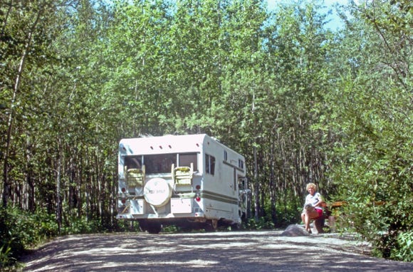
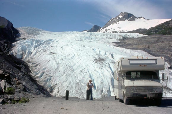
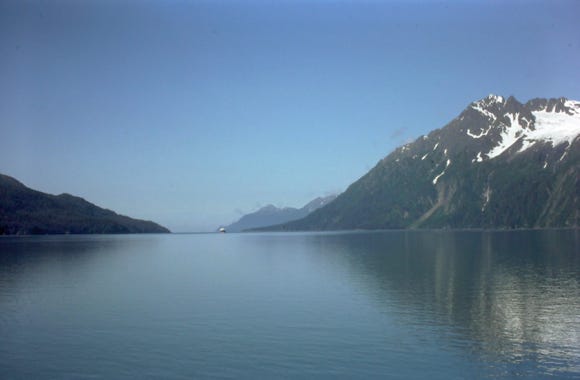
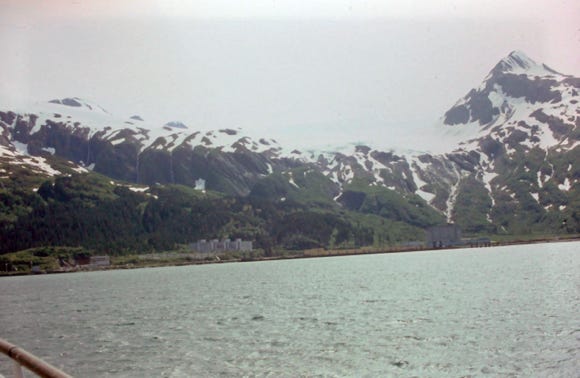
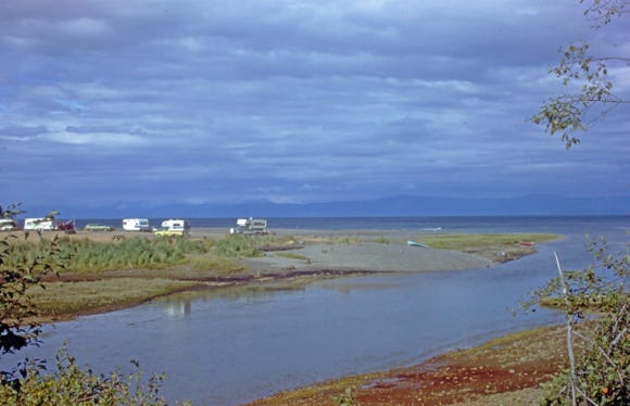
Here We Are At Portage Glacier, Alaska On July 10, 1978
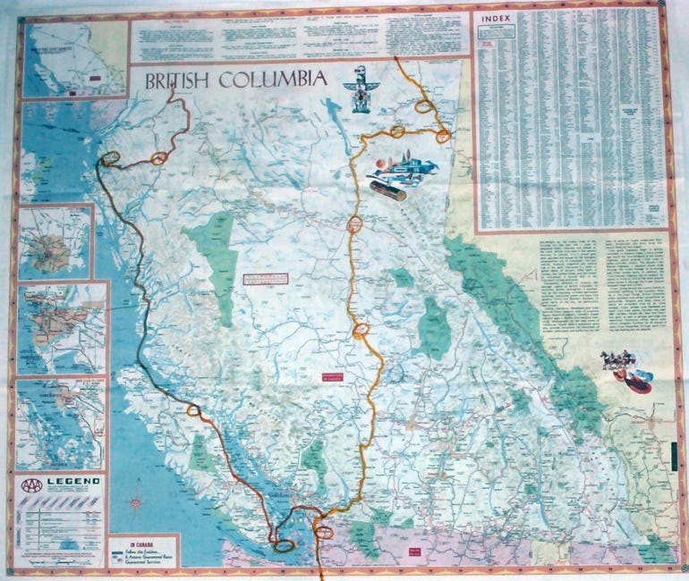
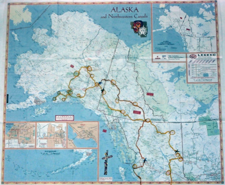
The Above Maps Shows Our Route From British Columbia To The Yukon Territory To Alaska. This Was A 8,000 Mile Trip.
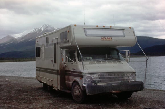
After our three tips to Mexico, we decided that since we still had the 19-foot Lazy Daze motorhome it would be a good RV to drive the Alcan highway. Our retirement plans are coming together with a possible date of retirement in 1980, so this RV would be just right for this trip.
We planned this trip for over a month making our screen guards for the front windshield of the RV, Lexan covers for the headlights and other windows, as well as fiberboard for the side windows of the RV, and even wrapping the gas tank. We did not take the Honda Trail 70 motorbike with us as we felt that with this trip and the dirt roads and construction, we did not want to get it damaged.
We used the motorbike rack and mounted two 12 x 16.5 Goodyear tires on the front so that we would have spares with us since we would be driving over 3,500 miles of dirt roads.
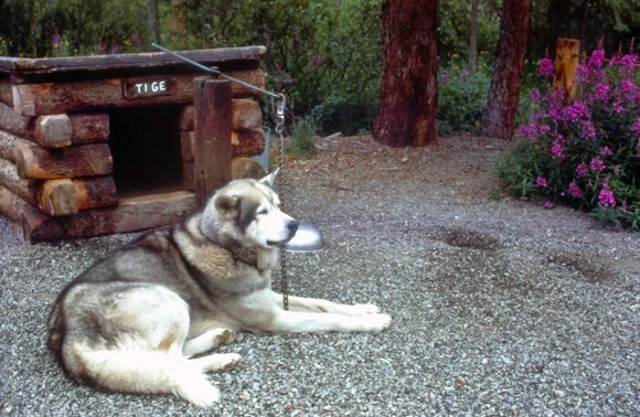
After Lady I, passed away in 1976, we had a new co-pilot for this trip, we named her Lady II very original. I guess we just liked the name Lady and decided to call her that. Lady II was 6 months old when we got her from the Humane Society, and she was a seasoned traveler by the time we made this seven-week trip to Alaska.
We left Eagle Rock, California on Saturday, June 24, 1978, and drove north on Interstate 5 to the border crossing at Sumas, Washington. When we checked the gun regulations for traveling into Canada and Yukon it was legal to take handguns in your RV when you were going to Alaska. When we got to the border crossing, they said that we had to leave our handguns at a local restaurant named Spud’s. We locked our guns in a secure box and left them there but that meant that we had to return out of our way to pick them up. We were able to keep our two 12 gauge shotguns in the RV.
The two maps show our routes to Alaska, and because we wanted to spend as much time as possible in Alaska, we drove day, and night to get to the border.
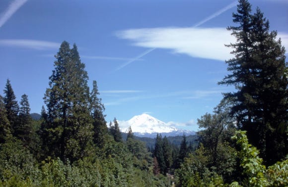
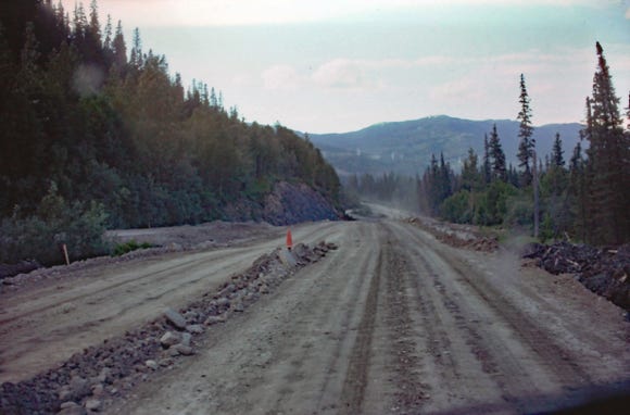

Along the way is a photo of Mount Shasta. We did not put up our screen guards or other covers since we knew we would be on paved roads past Prince George to Dawson Creek.
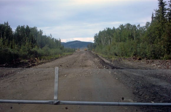
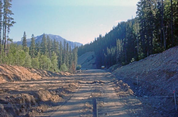
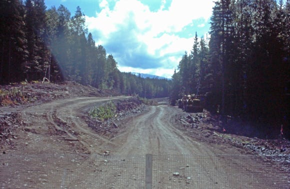
This was a mistake, as you can see by the construction zone that we had to drive on for over 80 miles from Prince George to Dawson Creek, also known as the John Hart Peace River Highway. Luckily, we did not have any damage to the windshield or headlights as most of the drivers kept their distance and were driving slowly.
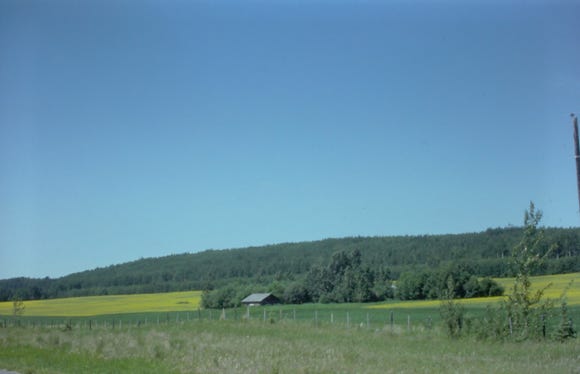
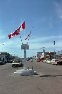
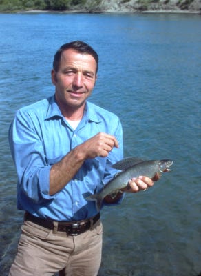
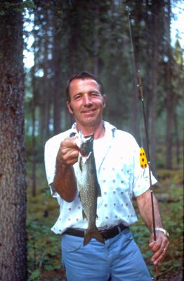
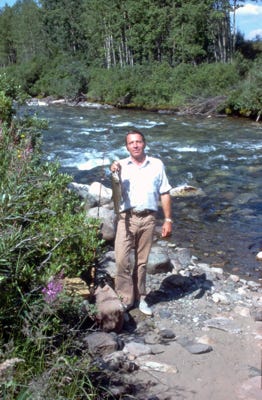
We arrived at Pine River just 20 miles before Chetwynd, B.C, and Bill caught a nice one-pound Dolly Varden often mistaken for a trout; this is a char. We spent the night here and the next morning we passed a farmhouse and a field of yellow flowers. We arrived at Dawson Creek at the start of the Alcan Highway and drove to Charlie Lake and spent the night at the campground.
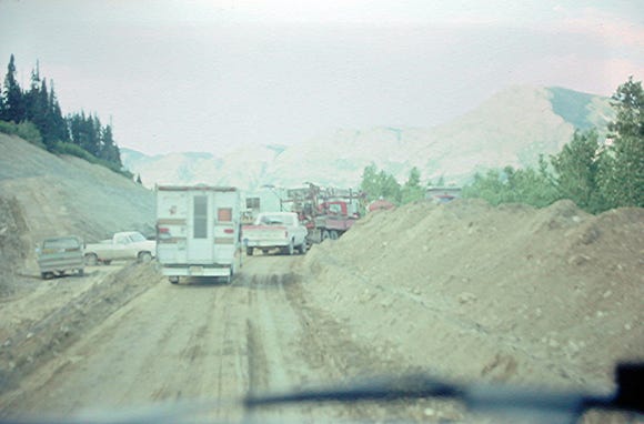
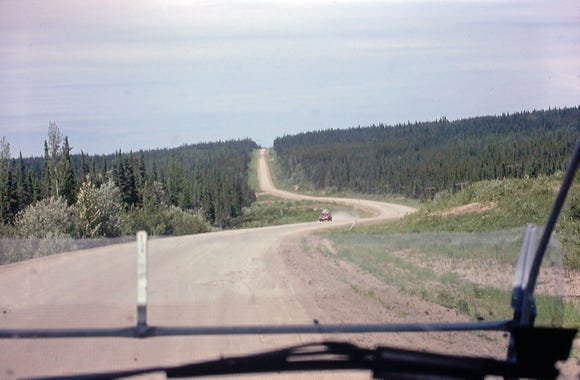
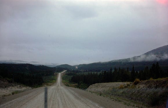
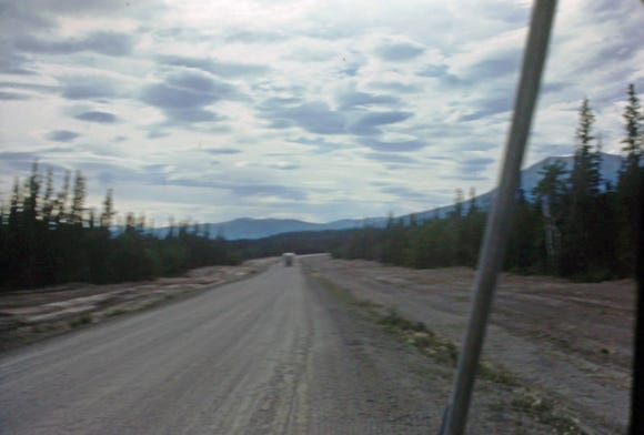
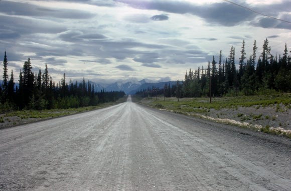
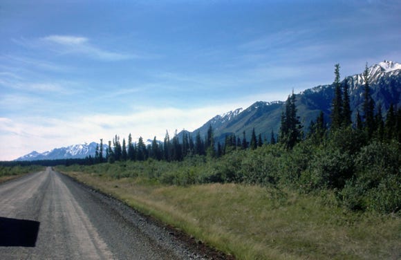
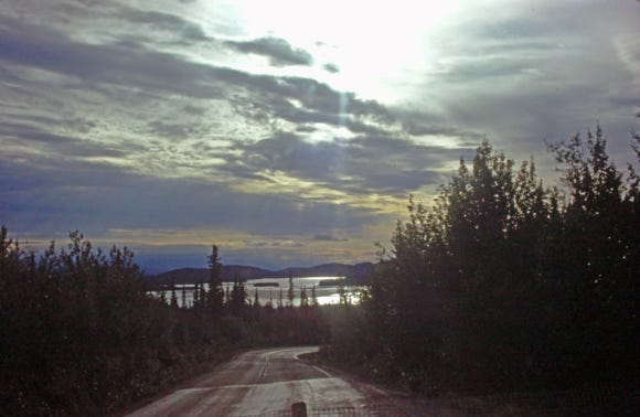
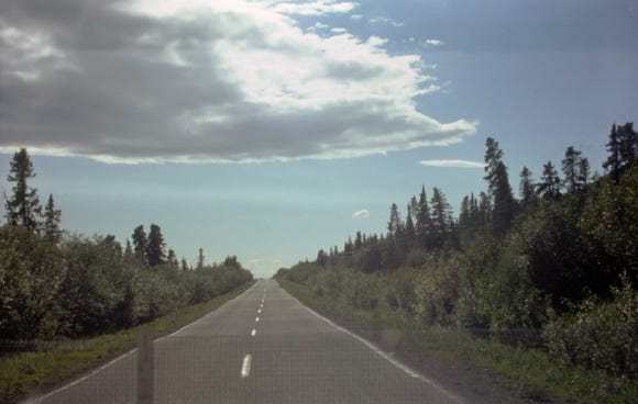
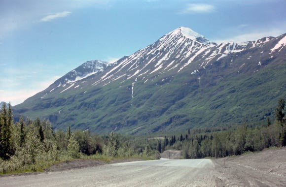
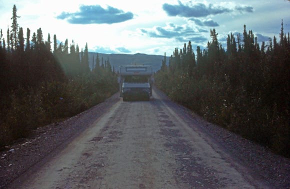
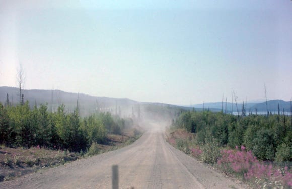
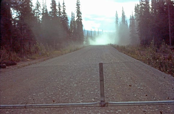
The next morning we put up all of our screen guards, Lexan covers and windows covers and we were on our way. A view of the dirt road going to Fort Nelson at MP 120.
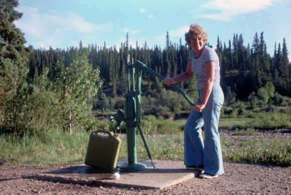


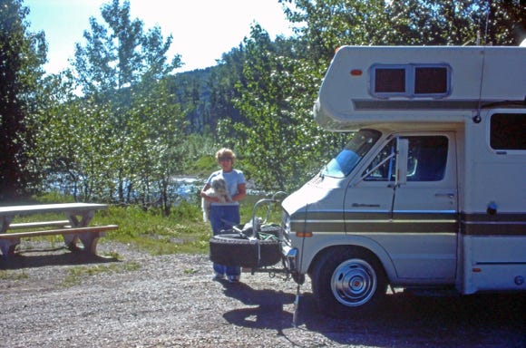
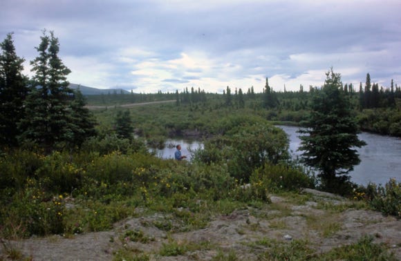
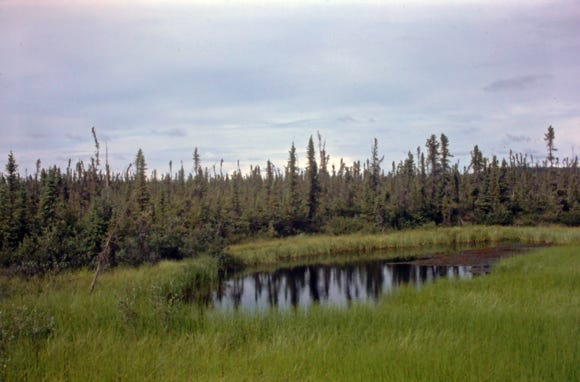
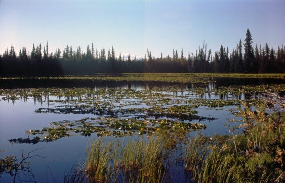
We arrived at Buckinghorse River Wayside Provincial Park, a scenic campground for those traveling to Alaska. You can see moose around the area and fish for Arctic grayling. The next morning Nancy is using a hand pump to get water into a 5-gallon container to transfer it to the RV. Along the route at various campgrounds, this was the only way to get water.
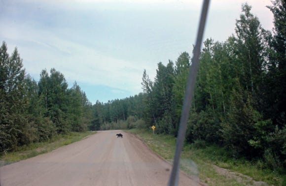
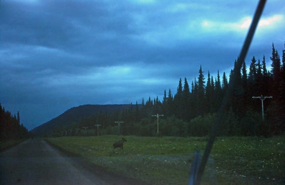
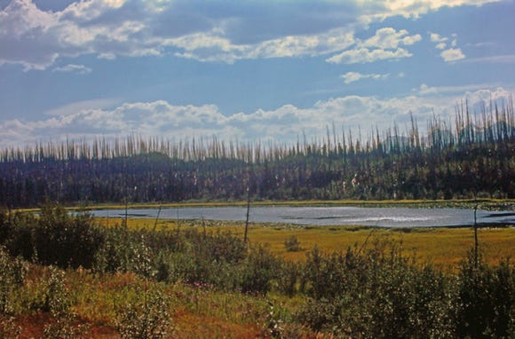
As you can see by the photos, we encountered road construction with a little more than lane-wide and muddy conditions along the route to Fort Nelson at MP 243. We took a photo of a bear crossing the road and a moose on a stormy day in a lush field.
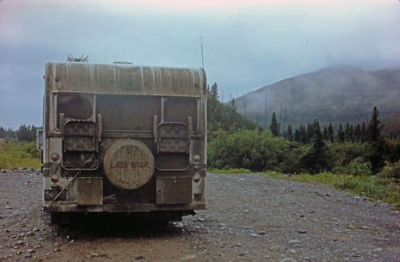
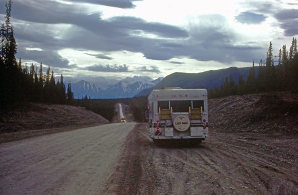
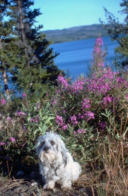
Now, we are at Muncho Lake which is 7 miles long and about a mile wide, with a depth of 730 feet, at an elevation of 2,700 feet. It was cold and stormy with temperatures around 40 degrees, Bill did fish for a short while but did not catch anything, too cold and windy. The front of the RV is covered in dirt and mud with our screen guard in place and our spare tires on the bike rack.
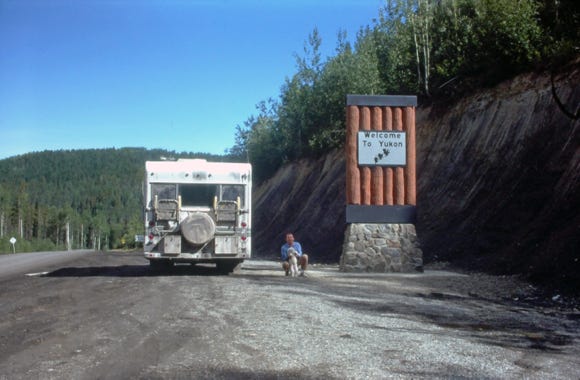
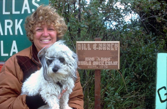
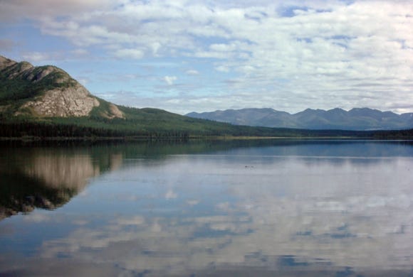
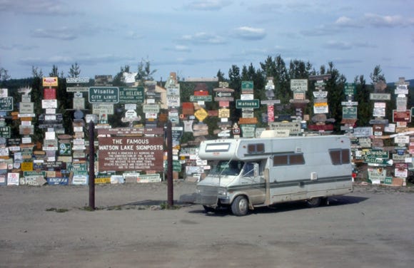
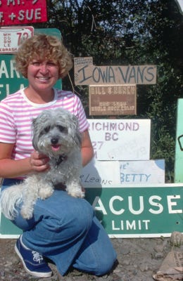
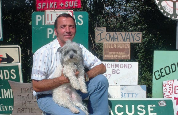
Passing the Liard River and a whirlpool in the canyon we arrive at the “Welcome To Yukon,” sign with Bill and Lady by the RV at MP 620. This area is known as the home of the Klondike Gold Rush. We are now at the famous “Watson Lake,” signpost at historic mile 635.
This tradition began during the Alaska Highway Project in 1942, when a U.S. soldier Carl K. Lindley was recovering from an injury. When he was asked to repair a directional signpost at Watson Lake he added his sign with mileage to his hometown of Danville, Illinois, and that started others to follow.
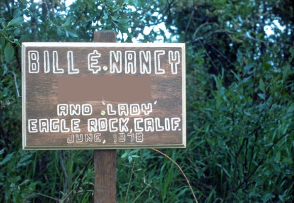
Before leaving on our trip to Alaska, we knew about the signpost area and made our special sign and mounted it along with many other signs. Bill is standing next to the Watson Lake signpost with our sign in his hand and with Lady in his arm. Nancy and Lady by their sign, you can see we picked a spot that was in an open area, but who knows where it is at today. There are over 80,000 signs and it continues to grow.
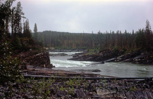
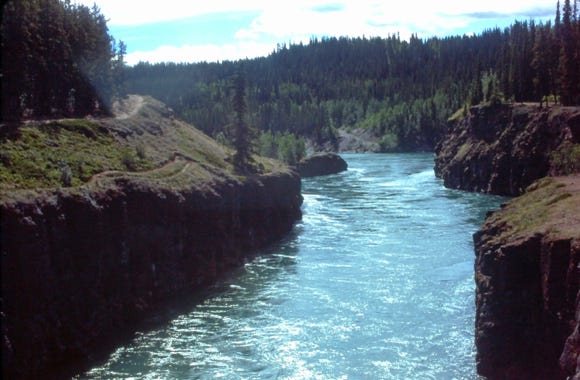
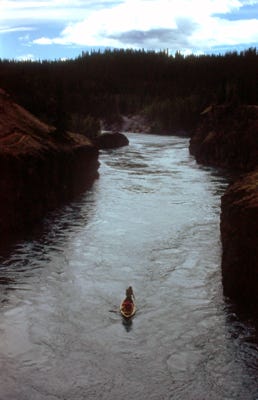
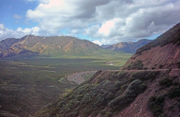
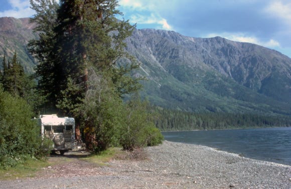
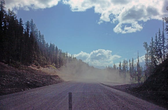
Leaving Watson Lake we continue to drive along another long area of dirt roads, and you can see by the back of the RV it is covered in mud. We stopped at the Yukon River, and Bill caught a nice grayling. This photo is of Miles Canyon, the headwaters of the Yukon River before we get to Whitehorse at MP 911.
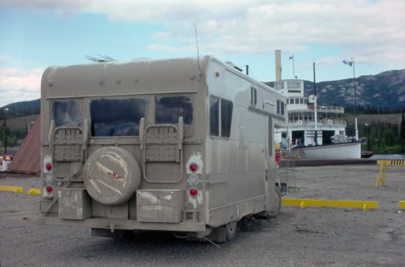
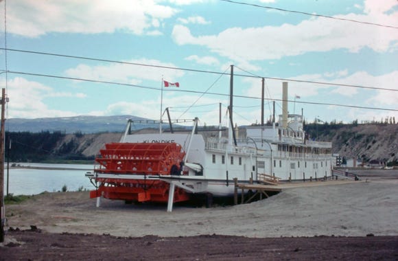
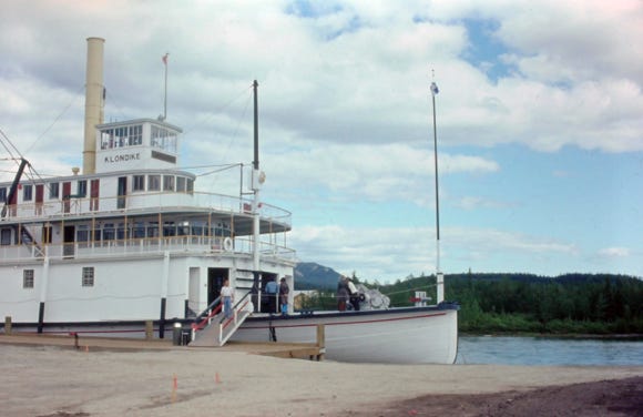
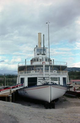
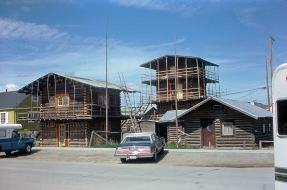
Photos of the SS Klondike, one of two stern wheelers that were moved through the streets of Whitehorse in 1968 to its present site. These were used to move freight between Whitehorse and Dawson City on the Yukon River. In Whitehorse are the Log Skyscrapers, built-in 1947 to provide housing for the construction workers for the Alaska Highway, the North West Staging Route Airports, and the Canol Pipeline.


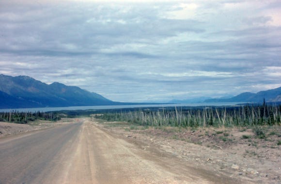
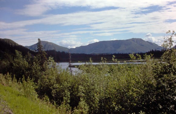
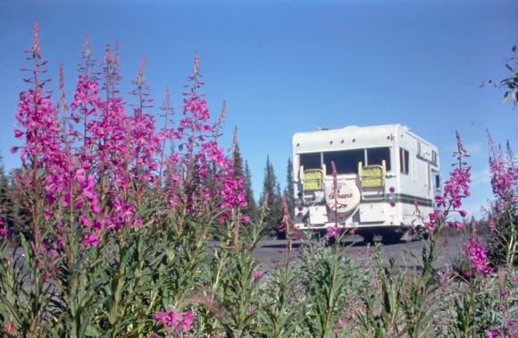
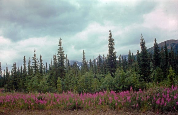
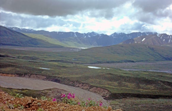
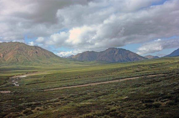
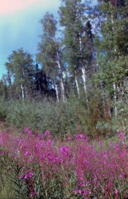
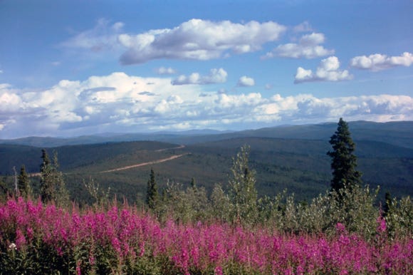
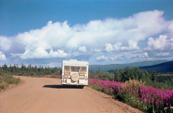
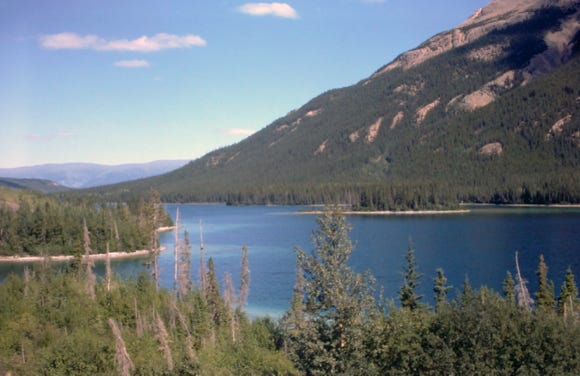
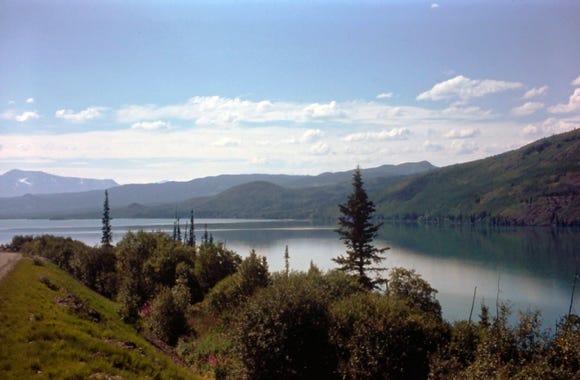
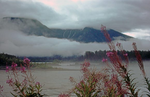
Leaving Whitehorse is a view of the mountains by Kusawa Lake at MP 958. At Champagne which is about 56 miles west of Whitehorse is an Indian village and a trading post. Driving along another long dirt road as we continue to Haines Junction in Yukon with a photo of fireweed along the side of the road.
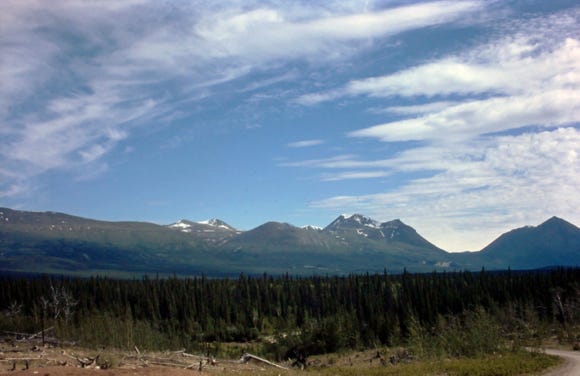
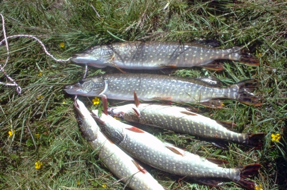
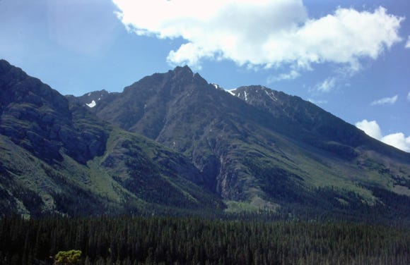
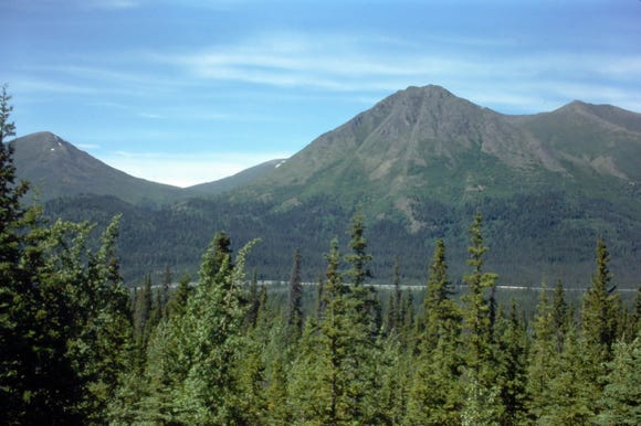
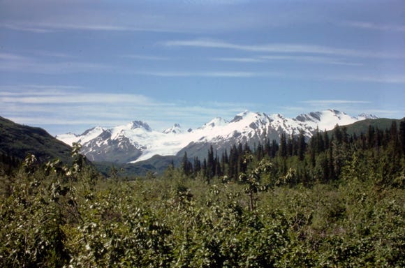
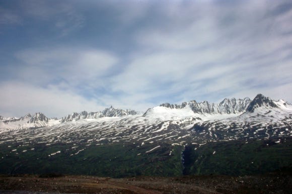
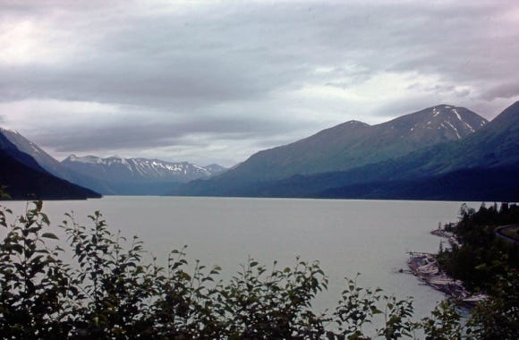
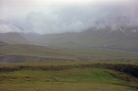
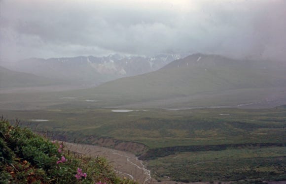
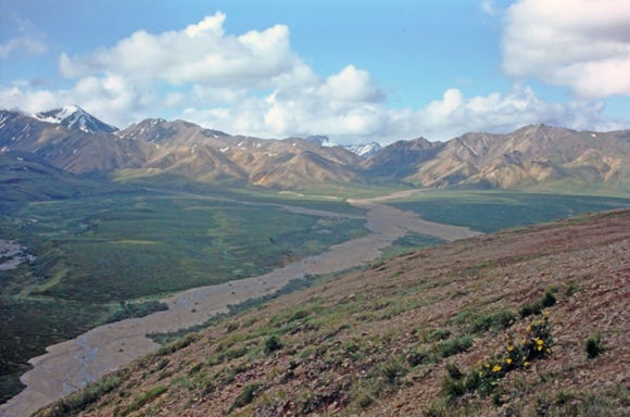
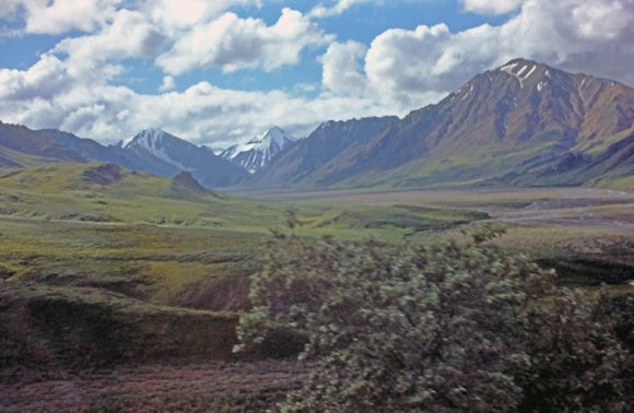
A view of the Kluane mountain range, where we camped at Jarvis Creek for the night, we fished and caught two whitefish and a grayling. We left the next morning and took a side road to Kloo Lake (an Indian word for fish), we fished from shore with a red and white wobbler and caught five pike in less than an hour, each weighing about two pounds. After cleaning the fish we then drove to Klaune Lake and Horseshoe campground. A photo of the mountain range in the Klaune National Park and more dirt roads at MP 1202.
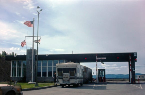
We finally arrive at the border crossing into Alaska on July 7th at 6:30 PM and are on paved roads.

We drove to Tok River Bridge campground, and a view of Island Lake, arriving at 10:00 PM, and it was still light outside!
With so many hours of daylight, we found that we could drive many hours with time to fish along the way and take photos. In June, the average daylight hours are around 21, with a brief period of the sun dipping under the horizon. At this time, the street lights rarely come on.
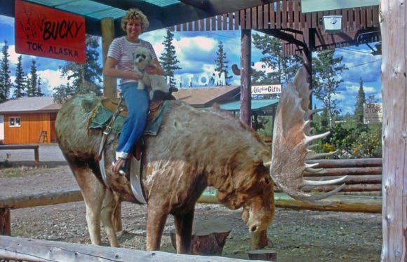
Arriving in Tok, it was time to re-group getting the RV washed now that we are finally on paved roads. Then a lube job, oil change, getting propane, and a stop at the “Bucky Moose,” where Nancy and Lady are sitting. Leaving at 6:30 PM, we arrived at Dry Creek at 9:00 PM and spent the night.
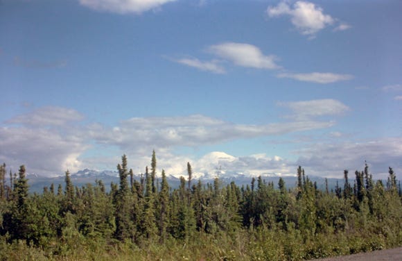
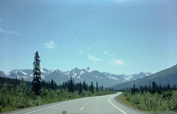
Leaving the next morning, we take the Tok Cut Off Highway 1 to Gulkana Jct. Along this route, you will see Mt. Sanford at an elevation of 16,000 feet. Something else we found as we were driving the paved roads is frost heaves, you can see by the photo this can slow you down as they sometimes can be severe.
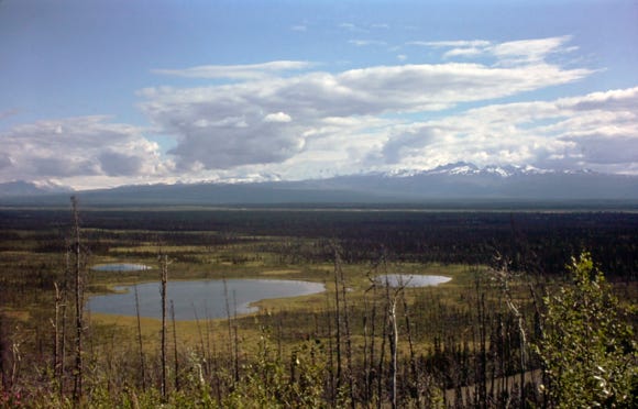
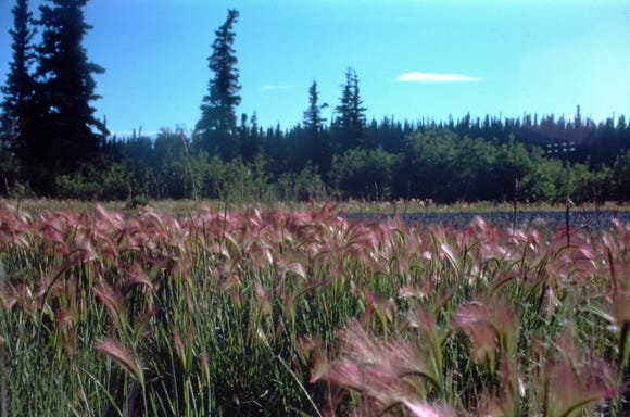
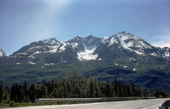
The scenery is very spectacular with meadows, marshes, cotton puffs in the wind, pink plumes of wheat grass, lily pads, and fireweed. In this photo, you can see the Alaskan pipeline that parallels the highway to Valdez. Photos of Willow Lake and the Wrangle Mountains at MP 88.
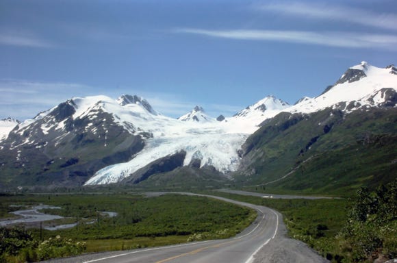
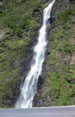
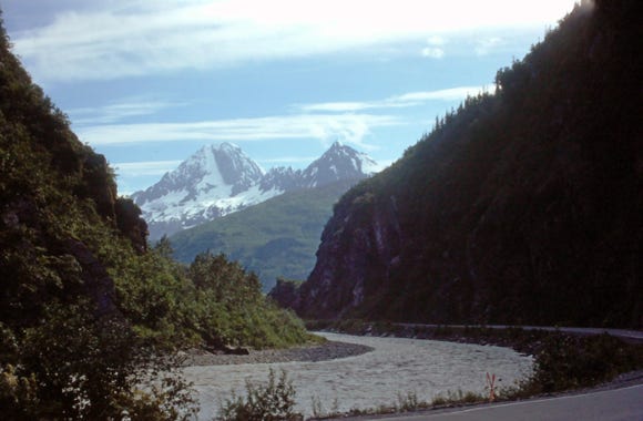
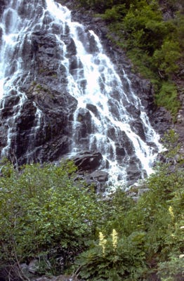
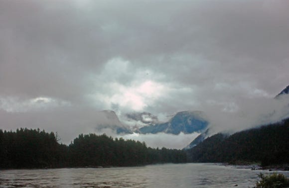
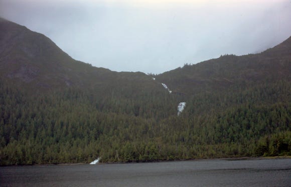
As we drive south along the Richardson Highway to Valdez, we pass the Chugach mountain range which is called “Little Switzerland Of America”, and another mountain range called Billy Mitchell and the Tiekel River. We arrive at the Worthington Glacier and then pass the Bridal Veil Falls in Keystone Canyon at MP 13, and then see the Horsetail Falls in Keystone Canyon.
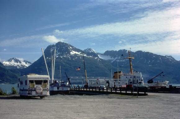
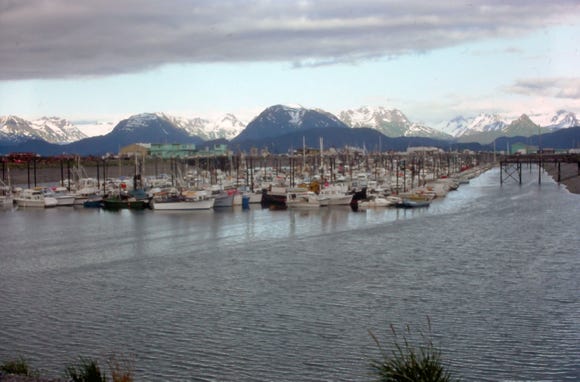
We arrived at the ferry terminal and boat harbor in Valdez on July 9th and spent the night at the terminal boarding the ferry in the morning to Whittier. We did not make a reservation, so we put our name on the standby list for the next morning and we were number two in line.
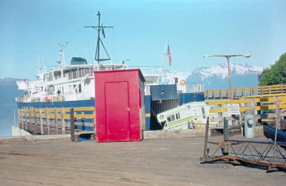
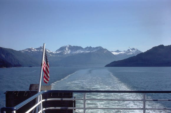
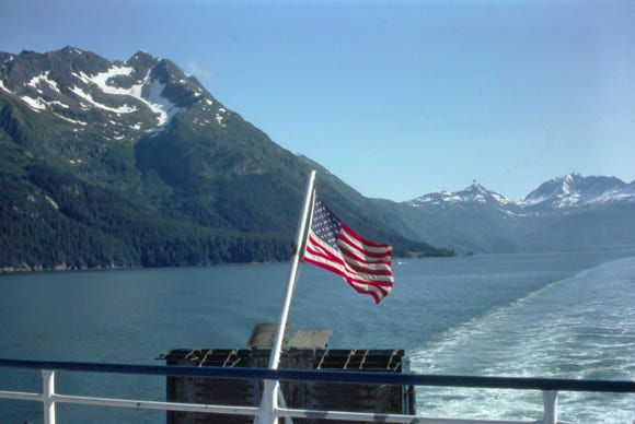
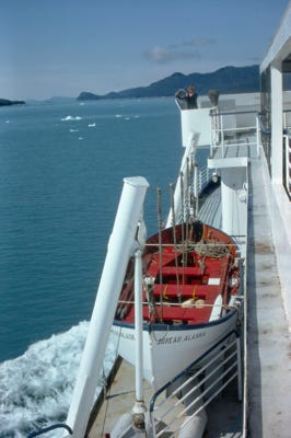
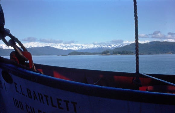
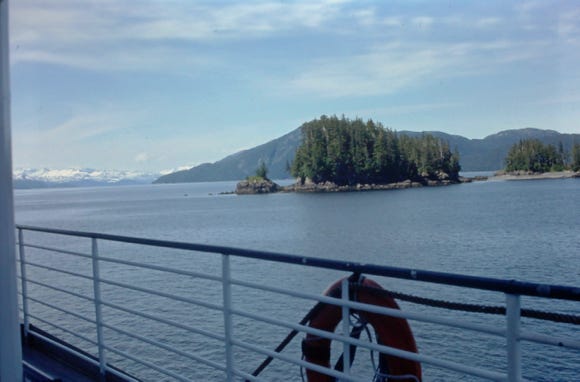

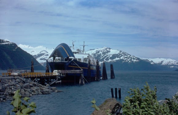
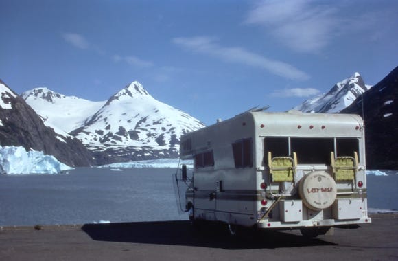
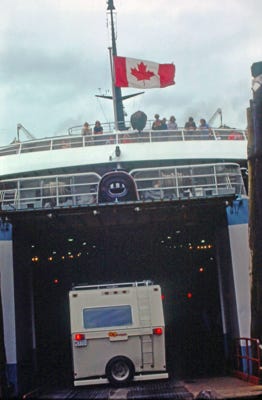
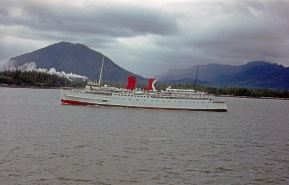
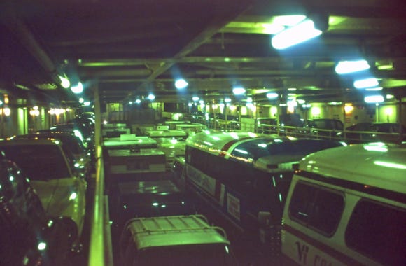
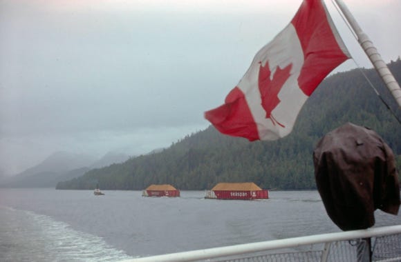
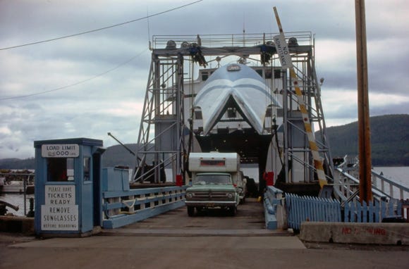
You can see the RV’s driving into the lower deck on the MV Bartlett ferry for the trip through the Prince William Sound to the Columbia Glacier and Whitter. The cost of this trip was $97.00 for the 19-foot Lazy Daze.
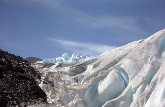
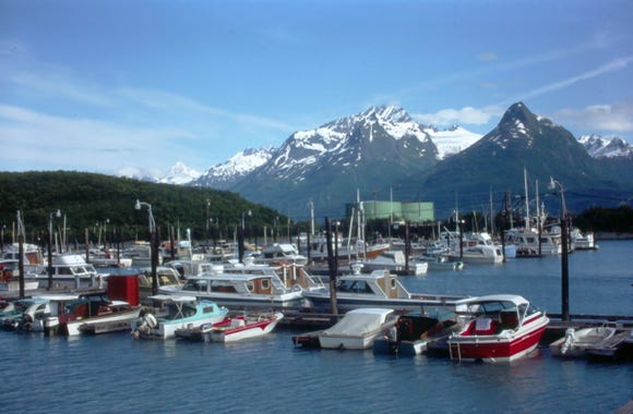
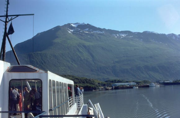
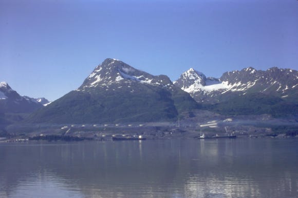
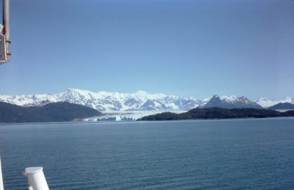
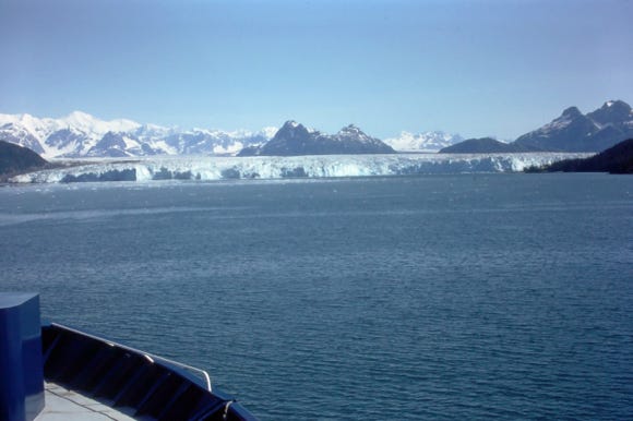
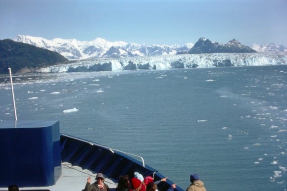
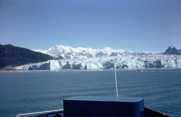
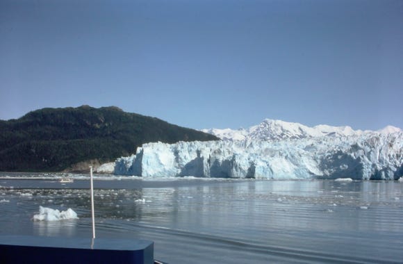
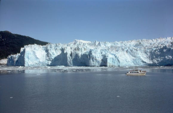
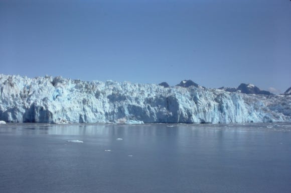
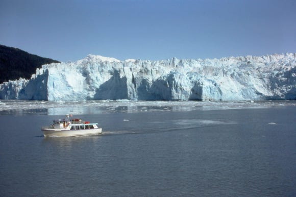
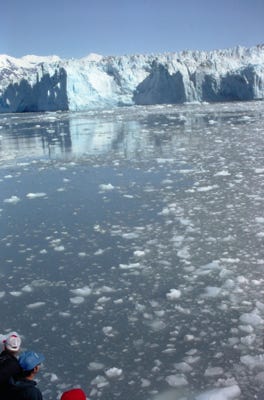
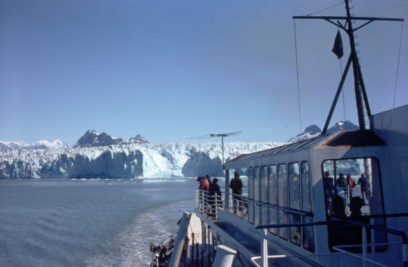
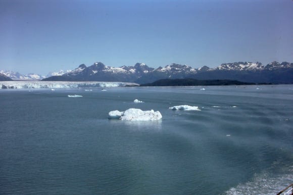
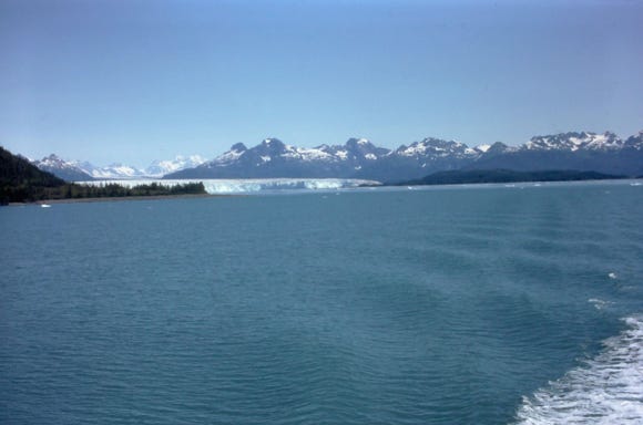
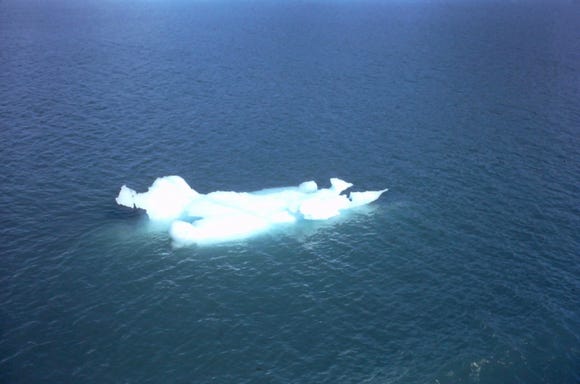
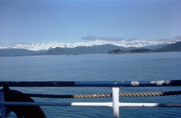
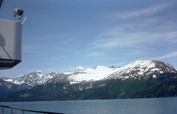
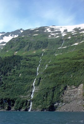
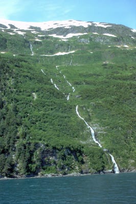
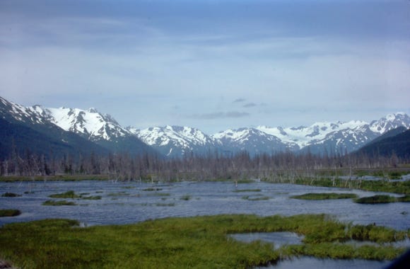
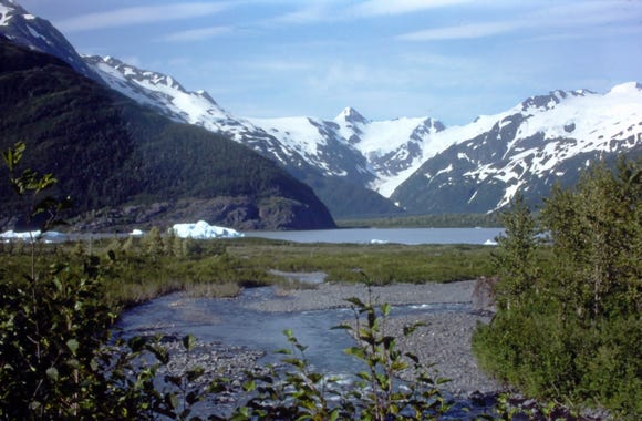
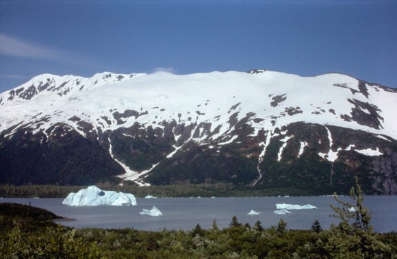
Cruising along Prince William Sound to the Columbia Glacier was spectacular. We were fortunate to have a sunny day without wind or clouds. You can see the photos of the scenery as we approach the Columbia Glacier. The Columbia Glacier is the second-largest tidewater glacier in North America and the largest in Prince William Sound, at over 700 feet thick.
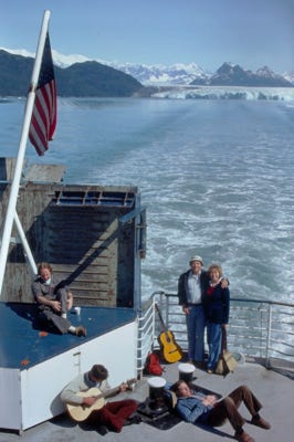
The ferry cruised the bay for about 45 minutes as all of us on board took many photos. You can see a small private cruise boat taking people to the glacier. We saw floating icebergs and small islands with pine trees and waterfalls. The MV Bartlett ferry at the dock in Whittier.
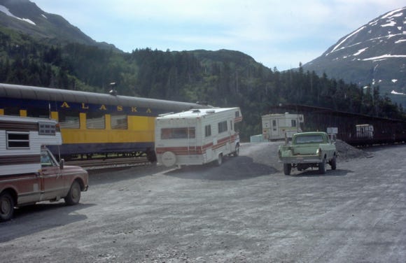
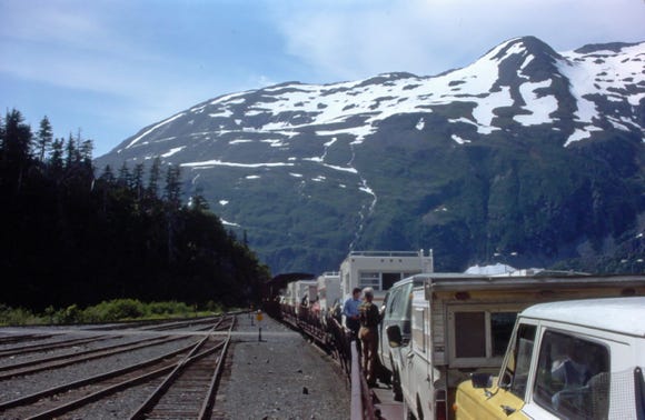
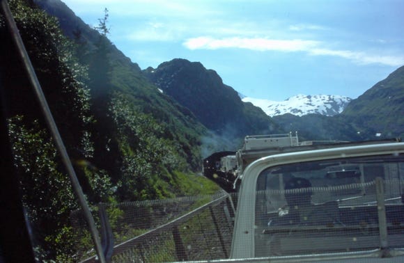
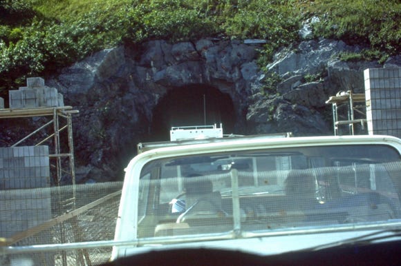
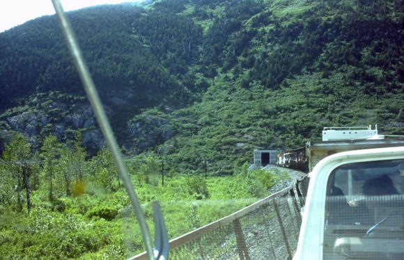
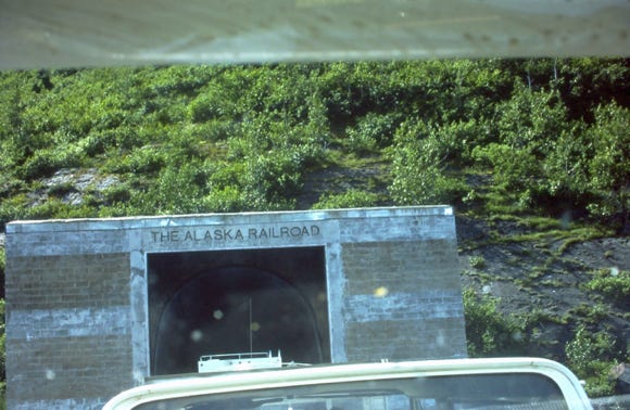
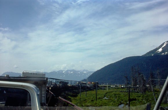
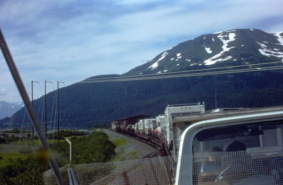
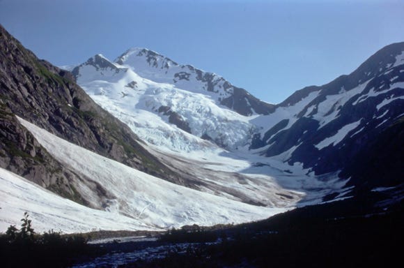
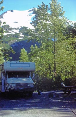


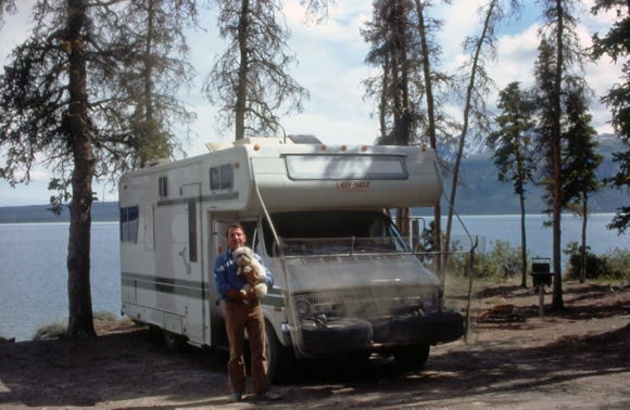
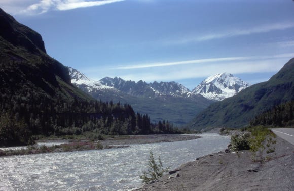
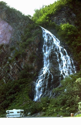
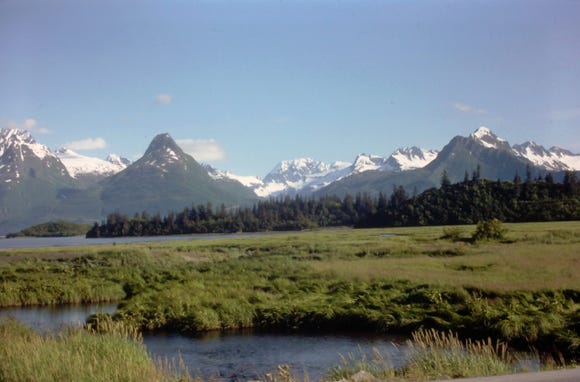
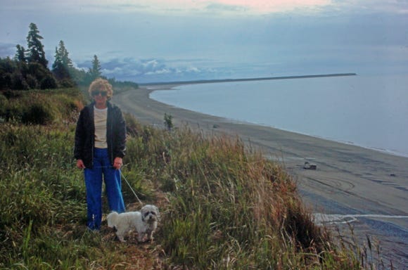
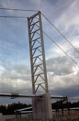
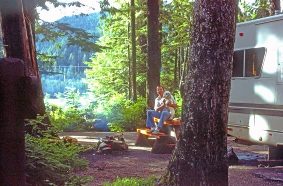
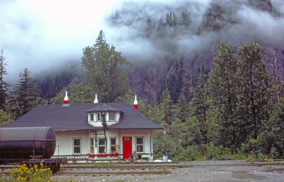
We then took the train to Portage Glacier for a fee of only $18.00. This was a fun way to travel, and the trip took about 30 minutes. Portage Glacier is located in the Chugach National Forest and as we sat on the front seat of our RV we took photos of the area and going through the tunnel. We arrived at Portage Glacier at 6:30 PM and camped for the night for a fee of $1.00! Lady is sitting on the picnic table at the campsite.
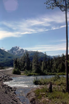
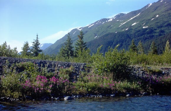
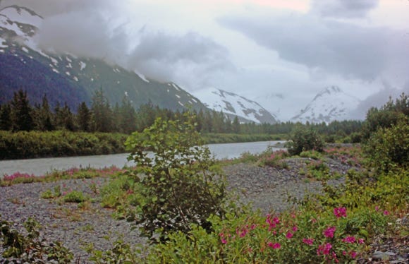
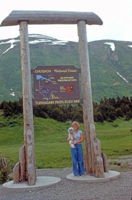
The next morning we left for Steward; it was cloudy with rain most of the day. We pass the Explorer Glacier on our way to Steward, Nancy, and Lady are standing under the Turnagain Pass sign with an elevation of 988 feet with an average of 12 feet of snow a year.
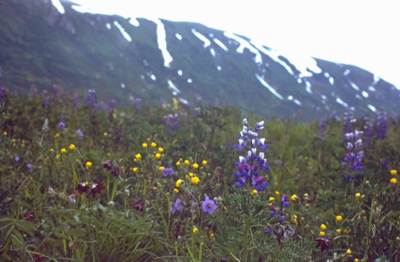
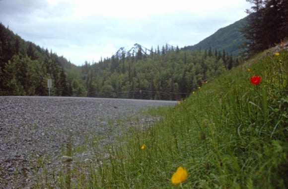
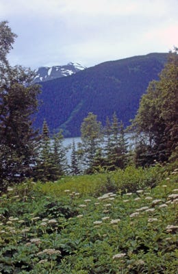
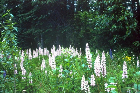
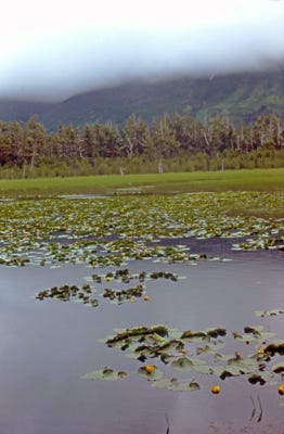
A view of Kenai Lake at MP 104 and rare pink albino lupines.
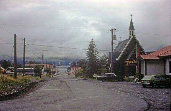

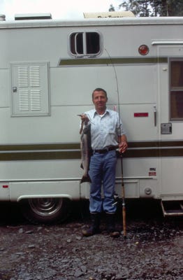
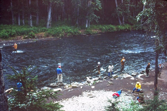
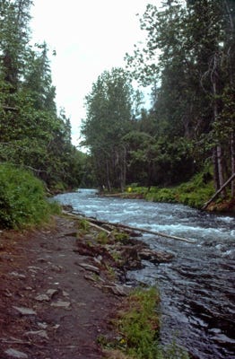
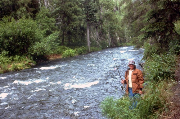
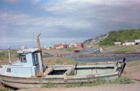
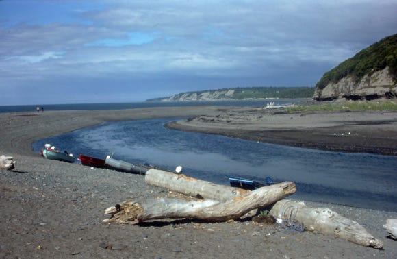
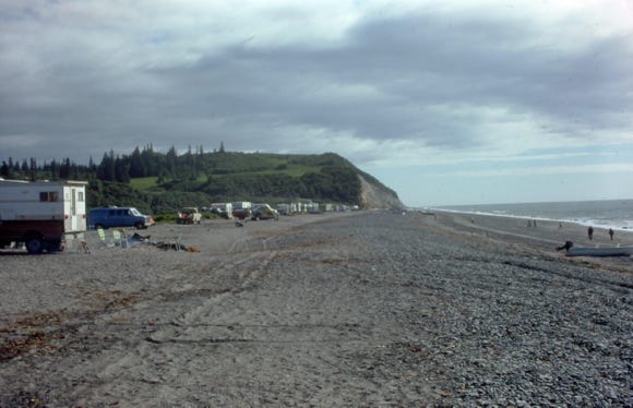
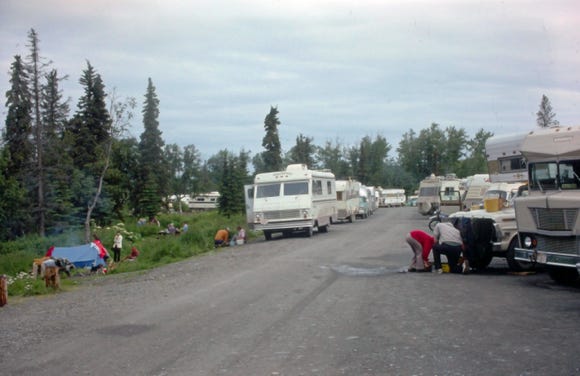
Arriving at Steward, we found a great restaurant to eat at and then drove around town and spent the night. The next morning we drove to the Russian River and found that all of the 100 campsites were full. We camped in the parking lot, and we hiked down to the Russian River where Bill caught a 6-pound salmon with a red and white wobbler.
During the week of July, 4th there was a large salmon run going up the river for two weeks, the campground was full and people were parking on the main highway and hiking down to the river to catch salmon. The weekends are extremely crowded this time of the year. We hiked up to the falls area on the river and fishing was slow.
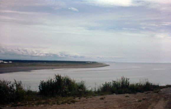

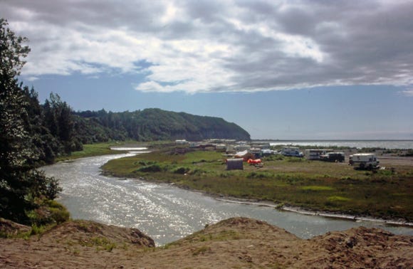
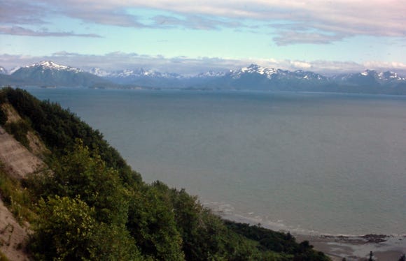
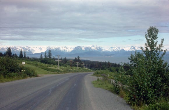
We left the area and drove to Ninilchik located on the Cook Inlet, where some of the best salmon runs in the state occur. Located about 40 miles south of Soldotna, it was once an area of people of Russian lineage who began settling in the area in the 1840s. Ninilchik is also one of the oldest Russian settlements on the Kenai Peninsula.
With panoramic views of Mount Iliamna and Redoubt, the Deep Creek State Recreation area is a popular spot for king and silver salmon and halibut fishing in Cook Inlet.
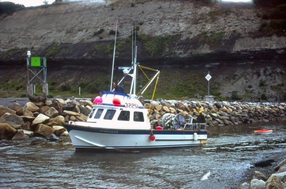
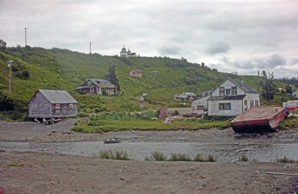
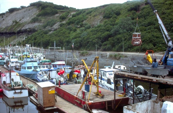
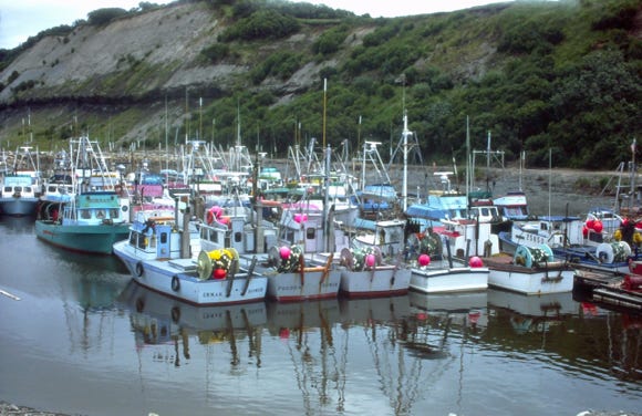
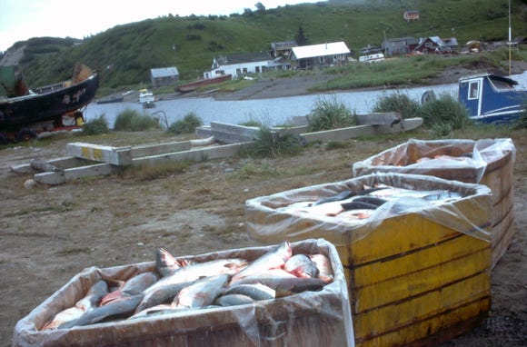
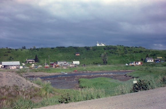
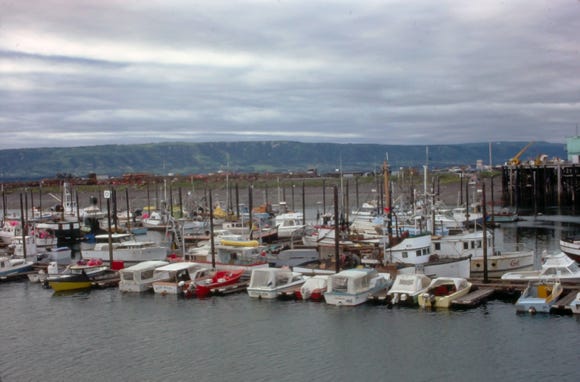
The town’s picturesque Russian Orthodox chapel is a highlight of the area. Photos of the boat harbor and containers full of salmon. Deep Creek and salmon spawn at the inlet of Deep Creek.

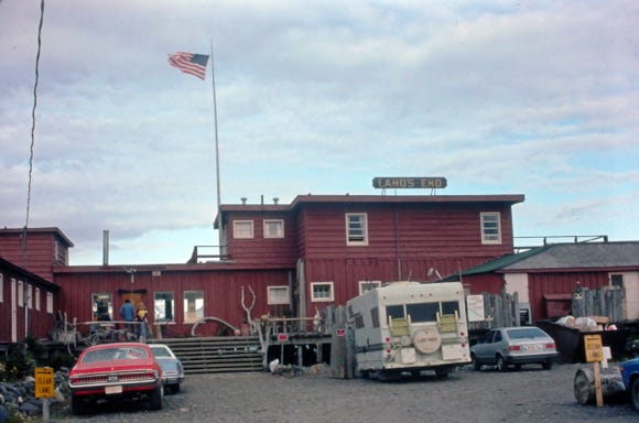
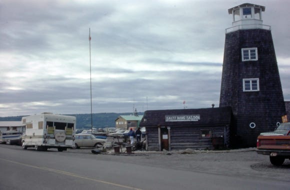
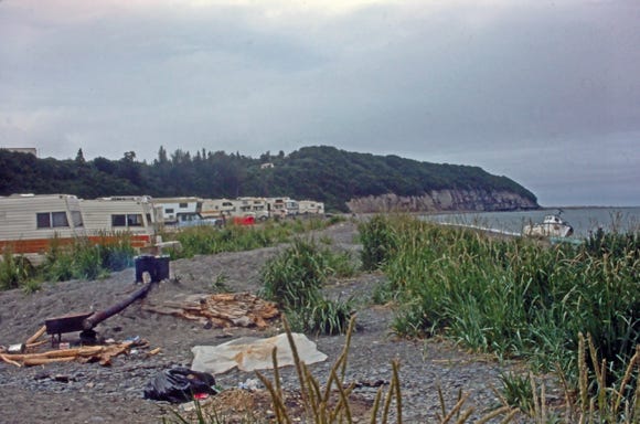
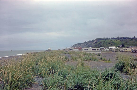
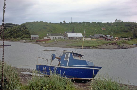
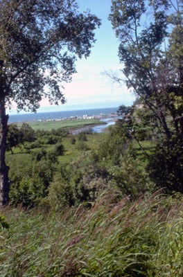
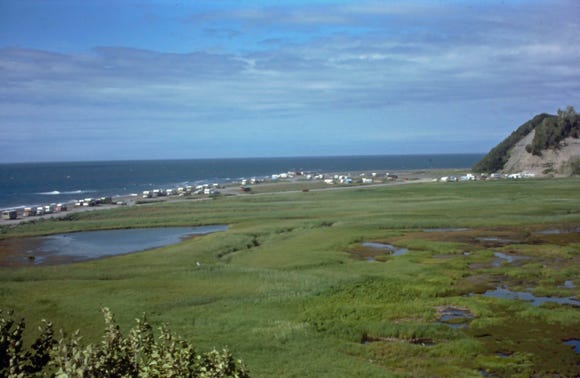
We are now heading for Homer and Land’s End and the Salty Dog Saloon; we camped on the spit at Homer for the night. Remember that we said that we were at “Land’s End,” at the southern point of the Baja Highway, well we made it to the world-famous Homer spit that is a 4.5-mile-long gravel bar road into the ocean waters in Alaska.
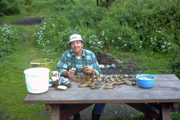
The next day we drove to the famous “Clam Gulch,” and in two hours we dug 85 razor clams that took us three hours to clean! These are hard to clean but, Nancy did make some great clam chowder. We understand that now the area is closed to clam digging.
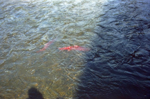
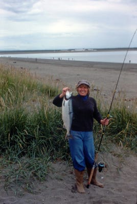
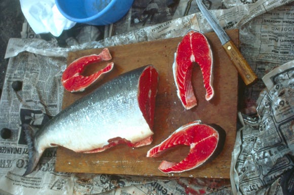
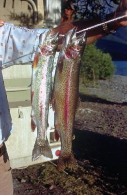
We arrived on the Kenai Peninsula and fished for salmon off of the surf casing large treble hooks into the surf and reeling them into to shore. We each caught a sockeye salmon and you can see the red meat as we fileted the fish.
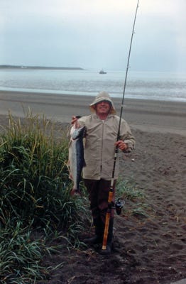
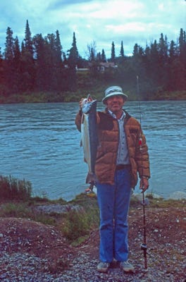
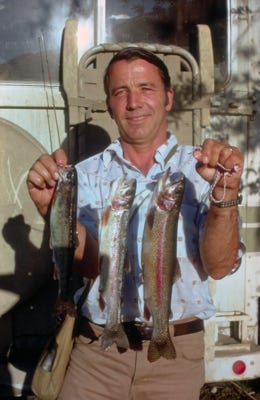
We stayed at a campground in Soldotna and Bill was fishing on the Kenai River by Spruce Street Road and used a jig and caught this nice 8-pound sockeye salmon and we lost three other fish that day. The next day Bill caught an 8-pound and 10-pound salmon that we traded in for canned salmon since our freezer was full of salmon and clams.
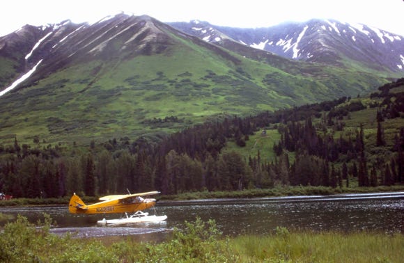
A view of a float plane on Summit Lake at MP 81.

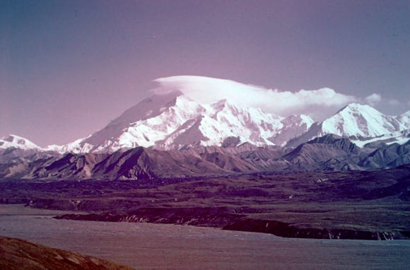
Leaving Soldotna we pass fireweed along the highway as we go to Anchorage and then to Mt. McKinely now officially renamed to its original name of Denali by the native Alaskans in their Athabascan language.
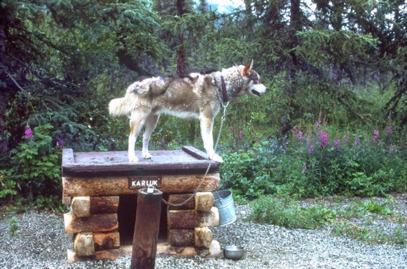
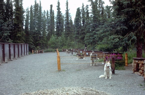
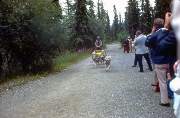
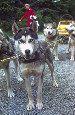
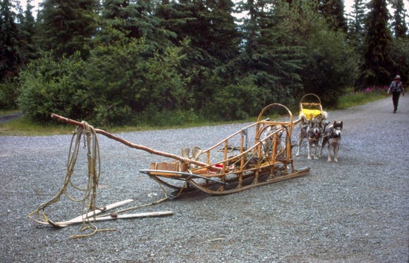
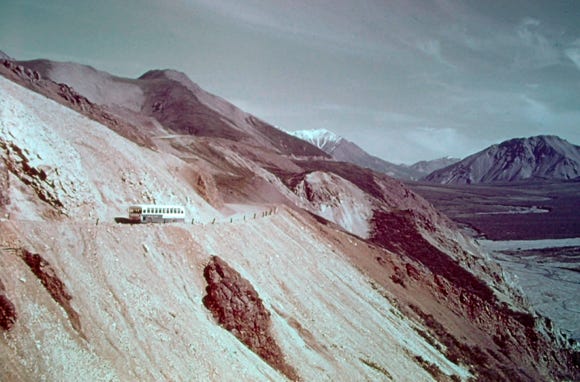
The campground was full, but we saw another Lazy Daze parked in a site, and they invited us to park next to them in the site for the night. The next morning we toured the Denali’s Alaskan huskies and saw the demonstration by the park ranger. Denali is the only national park with a kennel of sled dogs.
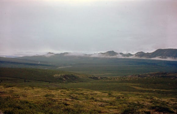
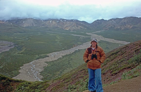
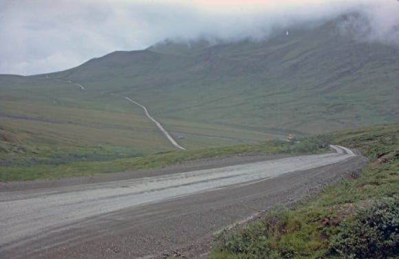
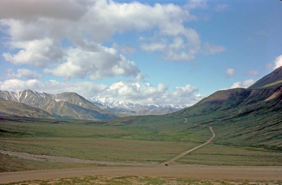
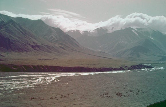
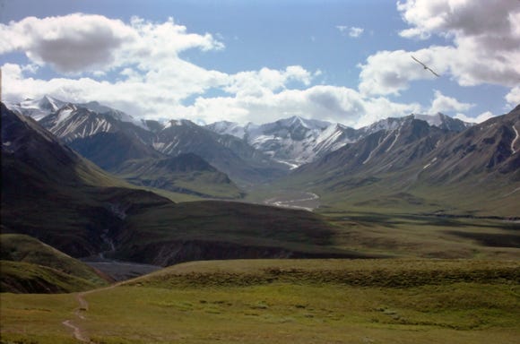
The next day we got on the bus tour to Denali; it was cloudy and cold with some rain. Denali is six million acres of wild land, bisected by a one-lane road. This is North America’s tallest peak at 20,310 feet in elevation.
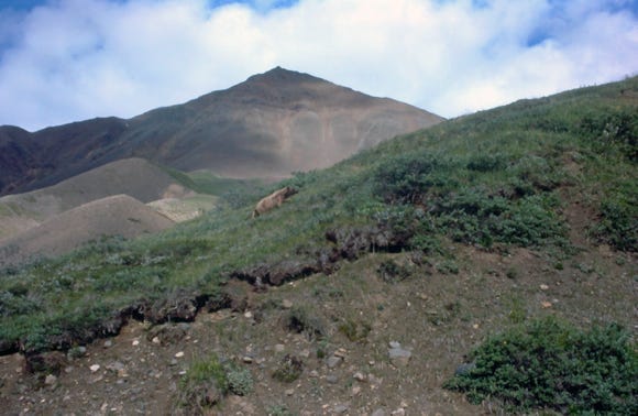
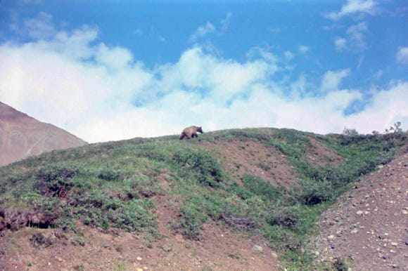
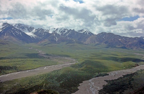
We did not get to see Mt. Denali because of the low clouds, so the next morning we went on the bus tour again and we got some great photos of Mt. Denali and the area. We took a photo of a grizzly bear walking up the side of a mountain, and other wildlife as we toured the area again.
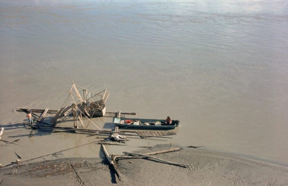
Leaving Denali we are driving on the Fairbanks Highway and take a photo of a fish wheel at Nenana on the Tanana River. The famous Nenana Ice Classic started in 1917 when tickets were sold to guess the date and time when the ice officially broke up on the river.
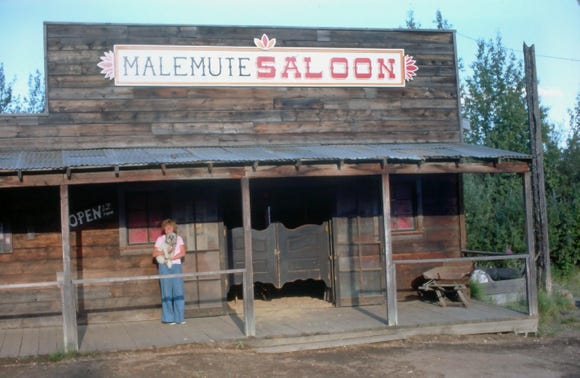
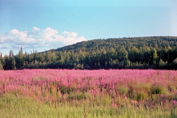
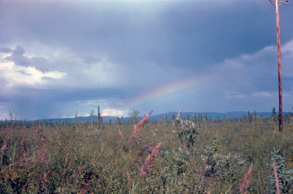
A photo of Nancy with Lady standing in front of the Malemute Saloon, located at Ester Gold Camp in the town of Ester at MP 151. More fireweed and a beautiful rainbow on a cloudy stormy day.
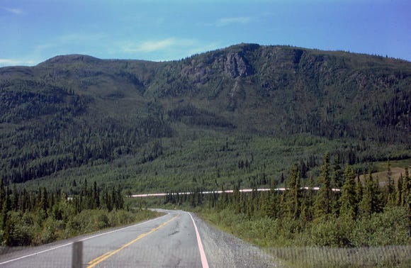
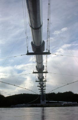
Views of the Alaskan pipeline crossing the Tanana River. The crude oil pipeline was built between 1975 and 1977 at a length of 800 miles going from Prudhoe Bay to Valdez Marine Terminal. The diameter of the pipe is 48 inches and has shipped over 17 billion barrels of oil since 2014. With many pumping stations, it creates a constant flow of oil at 4 miles per hour and would take nine days to arrive at Valdez.
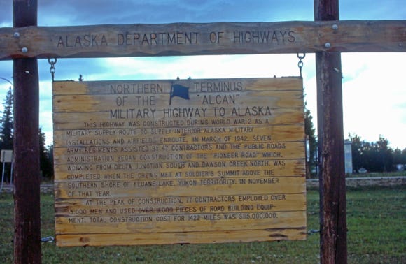
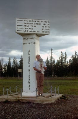
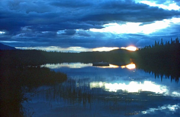
Arriving at the sign of the Northern Terminus of the “Alcan” Military Highway to Alaska, and Bill, and Lady in Delta Jct at MP 1422 “The End of the Alaska Highway.” The road to Tok and arriving at sunset on Moon Lake MP 1332.
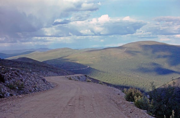

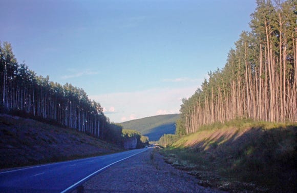
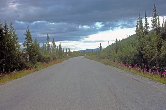
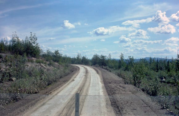
The next morning we are driving on Highway 3 (Taylor Highway) to “The Top Of The World,” also known as the “Skyline Drive.” This was a dirt road at the time of our trip to Dawson City. From Tok to Dawson City to Watson Lake were 1,200 miles of dirt roads.
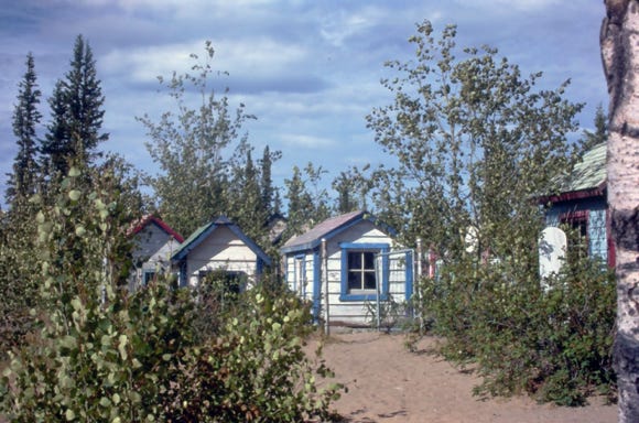
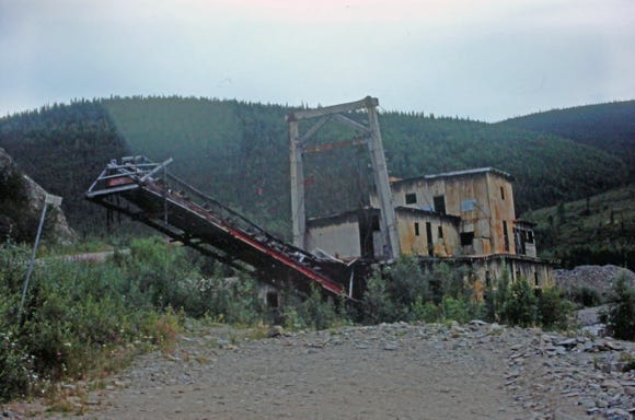
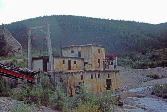
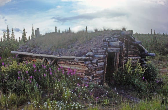
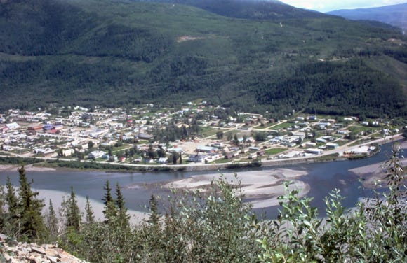
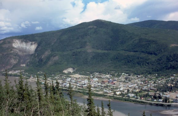
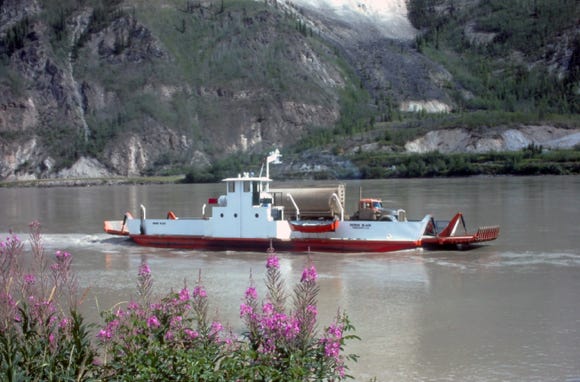
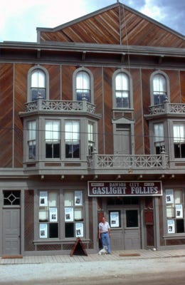
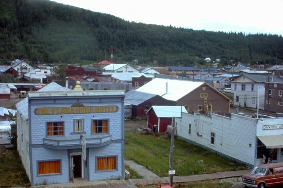
We pass an old dredge, more fireweed, and a prospector’s cabin out of wood logs. The overhead view of Dawson City and the Yukon and Klondike Rivers. A ferry on the river and a photo of the “Gaslight Follies,” building.
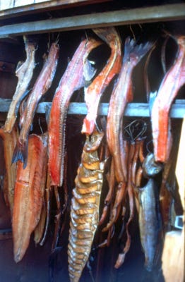
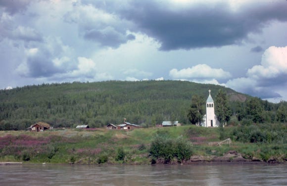
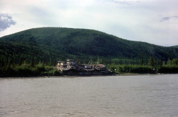
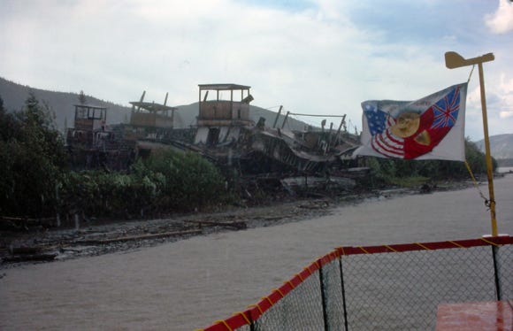
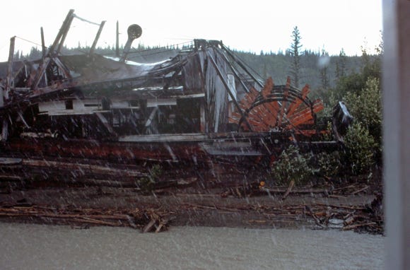
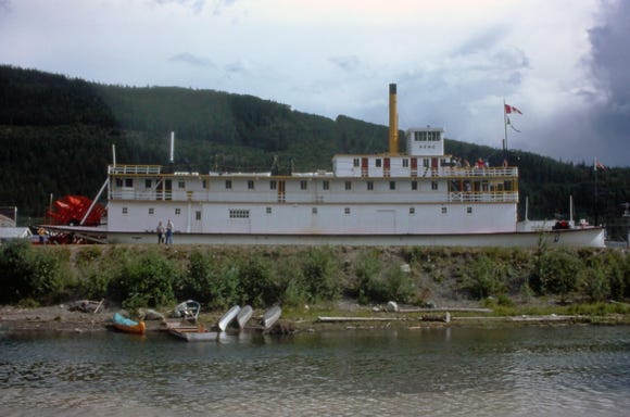
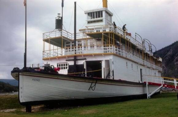
We took a boat trip on the river and got off to see the Indian village of “Moosehide,” and a photo of drying salmon and other fish. A church along the shoreline and a fishing wheel on the river. A photo of the paddle-wheeler graveyard and the SS Keno. The SS Keno was constructed in 1922 in Whitehorse and was the last paddle-wheeler to sail the Yukon River in 1960.
The famous Yukon River starts at the Bering Sea in the port town of Alakanuk and travels 2,300 miles through Alaska and the Yukon. The Yukon River is the longest salmon-producing river in the world.
The Yupik Eskimo people whose ancestors settled here over 10,000 years ago fished for salmon, and today is the only Native American fishery. It is a community-owned Kwik’pak Fishery that operates a modern processing plant in Emmonak, Alaska.
They process the Keta Salmon that is biologically programmed to store high-fat reserves to sustain them over the 2,300-mile journey upstream to spawn. Keta from the Yukon River has 3 to 4 times the oil content than chum salmon from any other region, and the most Omega-3 fatty acids of any salmon species. The flesh of the Keta is a deep orange to the reddish color of Sockeye Salmon.
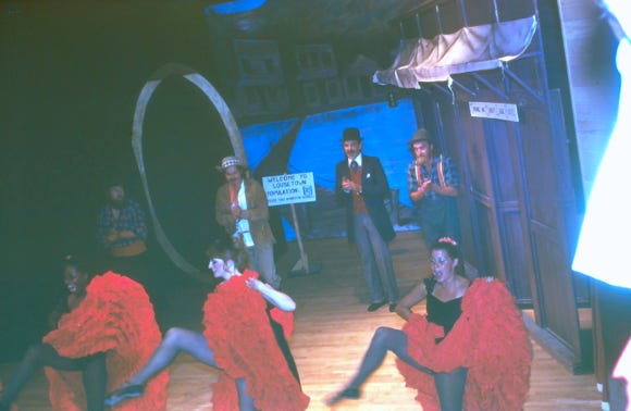
The Flora Dora Hotel in Dawson City and an evening at the “Gaslight Follies,” watching the performers dancing and singing.
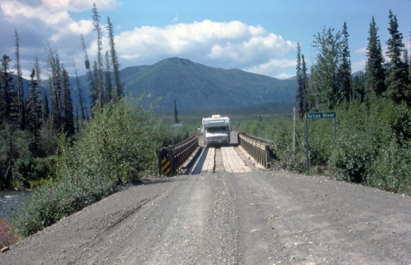
Leaving Dawson City on Highway 2 (Klondike Hwy) we approach a very narrow wooden bridge going over the Ketza River at MP 212. The Ketza River Mine was opened in 1988 for gold and silver mining and produced over 300,000 metric tons of gold. The Ketza mine owned by Veris Gold was abandoned in 2015, and now the government has a remediation plan to be completed in 2022 to clean up the pollution from the mine.
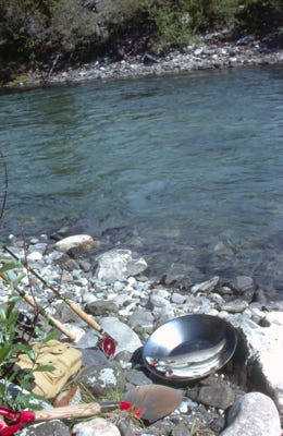
We stopped at Bonanza Creek a small tributary of the Klondike River to pan for gold, a local was charging $2.50 per pan so we thought why not try our luck? As you can see we did not get any gold but caught two nice grayling on the river. We left and drove to Moose Creek and arrived at 9:00 PM.
The next morning we drove to Carmacks and spent the night and leaving we are now on Highway 9 (Robert Campbell Highway). Arriving at Frances Lake we fished the Hoole River and caught five grayling using a yellow wobbler.
Arriving back at Watson Lake on July 31st we took photos of us, and you can see that more signs were added around our sign in a matter of just a few weeks. At Watson Lake, we did laundry and had to replace the distributor cap and rotor.
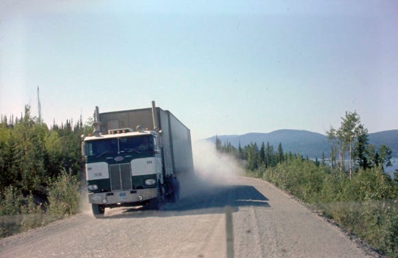


The next morning we left going south on Highway 37 (Stewart Cassiar Highway) pass Good Hope Lake. As you can see by the photo we still ran into major construction along this route, and a photo of Lady with Dease Lake in the background. We encountered many semi truck and trailer rigs along the Alcan highway and as you can see on this highway it was narrow with no shoulders. We usually drove over to the far right side and stopped on a small shoulder area as these large trucks passed us.
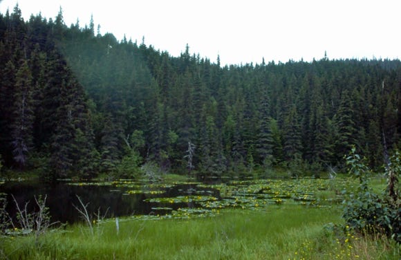
We arrived at Eddontenajon Lake and spent the night, and Bill caught a rainbow and lake trout. We pass Kinaskan Lake and a lily pond at MP 152. More highway construction along this route with some of the worst roads that we encountered.
Along this route, there were several forest fires so we had to keep up-to-date with the local road conditions, we arrived at a gravel pit and decided to spend the night and cooked dinner but the more we thought about this being too isolated we left at 8:30 PM and drove for two hours to a safer place to spend the night.
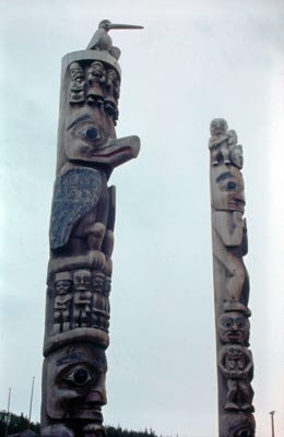
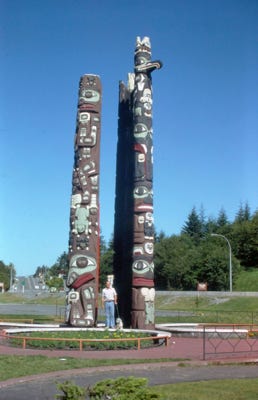
On August, 4th we had road construction for 22 miles and it took over 2 hours to get to Kitwancool to see some of the oldest-known and largest collection of totem poles in British Columbia, many over 100 years old. Many of these totems have been moved to the Royal British Columbia Museum in Victoria, but the “Hole In The Ice,” remains in Kitwancool.
A photo of Bill and Lady at Exchamsiks River Provincial Park with the Sitka spruce rainforest that towers over the park on the Yellowhead Highway at MP 137.

We are camping along the Skeena River, and the next day drive past waterfalls along the highway. The Kwinitsa Railroad station is on the Canadian National Railway mainline in Kwinitsa, British Columbia on the north side of the Skeena River across from the Yellowhead Highway 1.
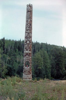
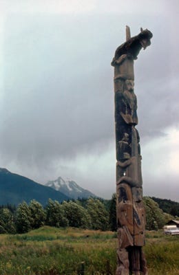
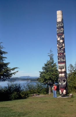
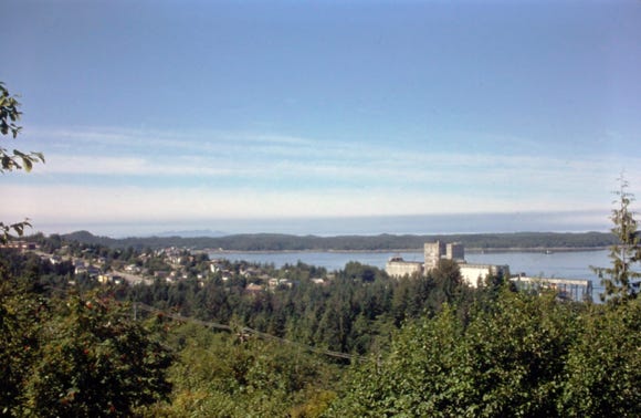
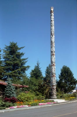
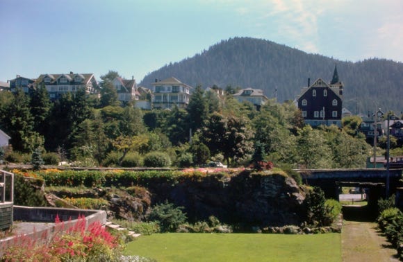
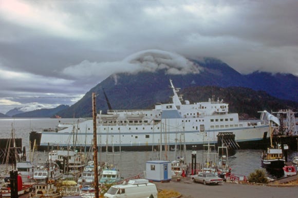
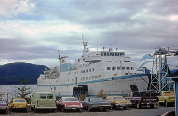
We arrived at Terrace and had to do some motor work on the Lazy Daze. During our trip, it was backfiring at times, either because of water in the gas or the carburetor. We arrived at Prince Rupert on August 8th at Port Edward and took more photos of totems in the area and the surrounding homes.
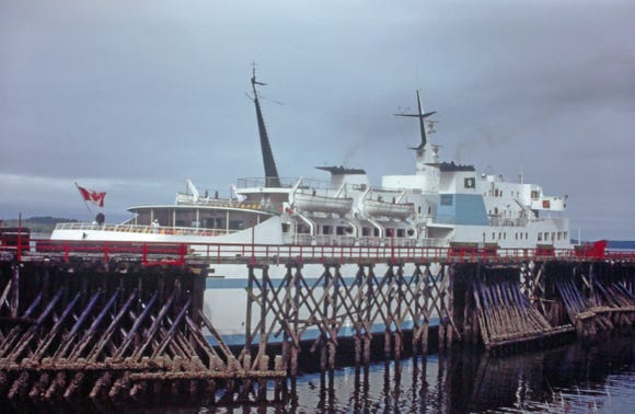
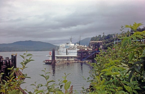
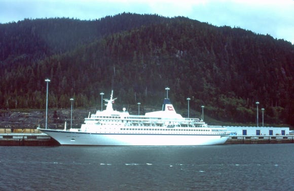
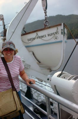
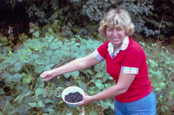
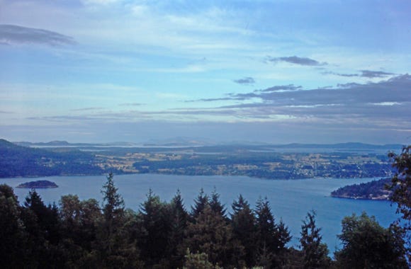
We boarded, “The Queen of Prince Rupert,” and docked at Port Edward on August 9th for our trip to Vancouver Island, it was cloudy with rain most of the day, and the trip took about 20 hours. The photo below shows the cars and RVs parked. We arrived at Kelsy Bay on Vancouver Island for our drive down the coast to Victoria, stopping to pick blackberries and take more photos of the island.
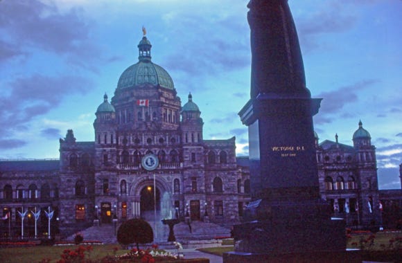
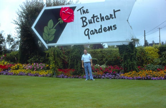
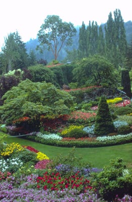
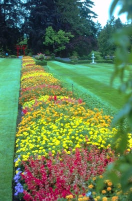
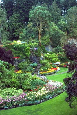
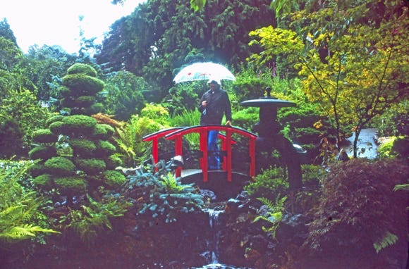
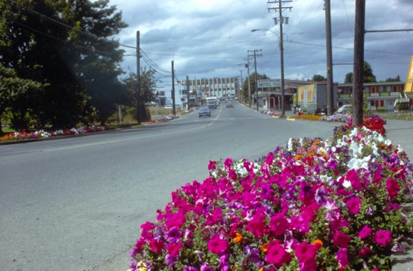
We toured the town and saw the Parliament Building and then went to “The Butchart Gardens,” with the beautiful scenery and flowers. After sightseeing the area in the morning we boarded the ferry from Sydney to Vancouver for the hour trip. We then had to drive back to Sumas, Washington to the Spud’s restaurant to pick up our guns that we left on June 26th and crossed the border at 6:30 PM.
We slept at a roadside rest area around Seattle for several hours before leaving at 3:00 AM the next morning and drove straight through day and night until we arrived home at 5:30 PM on Sunday, August 13, 1978. The next morning we left to go to work at 6:00 AM and worked a ten-hour day of our four-day work week, getting ready for another adventure.
This was a spectacular trip, and we saw and did almost everything that we wanted to do in Alaska, and the Yukon. Our trip was 51 days and 8,000 miles, a trip that we will never forget.